
Is 3D visualization really anything more than a tool to enhance product presentations or make a project look good to the company’s customers or top management?
“We did indeed complete 3D visualization of topside drilling rings back in the early 90, so I guess it, back then at least, had those benefits. It is a different ballgame altogether here though, where 3D adds significant value to navigating a well safer and easier.
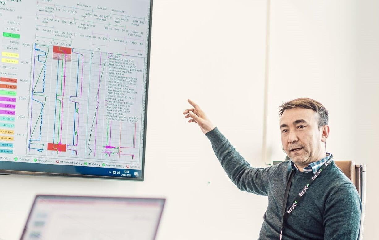
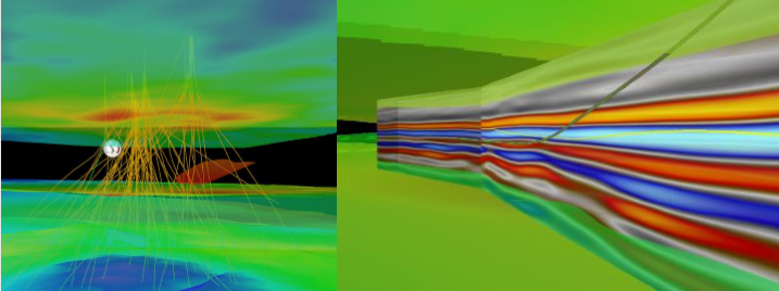
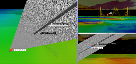
Initially, just viewing your well as it appears downhole, vs looking at it as squiggly lines, provides a better understanding as relevant multi-source info is available, visible, and displayed in its context. In addition, it is more than just visualizing proximity wells, formation and seismic layers, and various measured data at the bit and along the wellbore. You amplify what matters and turn down the noise on what doesn’t.”
So, an incremental upgrade on the existing 2D world then?
‘’No, not at all, it is so much more than that. Revealing what is relevant, visualizing what’s ahead, providing real time well status, all the necessary information, as well as advice, for you to make the next best move.
Connected with our AI software, the navigation software will detect, and alert you of anomalies long before you, or any other human for that matter, notices anything wrong. And, like location-based mapping services (e.g. Google) offers alternative routes, it suggests different measures to avoid trouble, and drill the perfect well.
We were the first to make a digital twin that truly mirrors a well. However, to steal from the map world, an accurate map is important, but it does not do much more than tell you where you are, and which directions or roads leads you to you destination. Everyone driving a modern car today knows, that is just one of the many things software helps you with needed for a perfect trip. Which was what we at eDrilling set out to do at the start of this well navigation software journey.
Why is AI so important, and what do you think the future of AI in 3D visualization will look like?
“Other solutions, while having accurate and up to data to visualize, does not give you much more than a snapshot of where you are. A solution powered by AI, utilizing a complete digital twin of the well, opens up a well of opportunities. AI is the equivalent to traffic data in mapping services in combination with vehicle status and weather data. Think recommending the fastest route to destination, windshield vipers automatically starting when rain hits, warning about delays due to weather conditions, or auto breaking when you did not pay enough attention.”
“Opening up for previously unknown levels of decision support, as well as speed and quality of decision, not to mention autonomous drilling. Not only do you get a true representation of your well, providing you with warnings and advice on how to avoid incidents, think stuck pipe, and a system telling you the current status on your important parameters, but also knowing what the optimal ROP, RPM or tripping speeds are. So, I’d say that real time parameter optimization is what will drive the adoption of real-time AI based well navigation going forward.”
What’s next for eDrilling in the navigation software space?
“We are launching an app store, allowing third-party providers to connect to our 3D well navigation platform. We will offer our customers more content and more precision, by adding more data, more information. I think it will be here that subsurface and drilling & well finally come together. And, yes, we will give you the opportunity to guide you with voice directions. And introduce the term “backseat drilling” to the world. Jokes aside, it's like having knowledgeable local resident riding along with you, but in this case one that knows the well like the inside of their hand.”